Before we even made it to Valentine’s Day the February precipitation record in the town of Jackson had already been broken. By the time Presidents Day was over, snow depths in the mountains had also broken records. I presume you might have to go back to the last Ice Age to find something deeper in February.
This winter has been like having two winters packed into roughly half a season. And we still have March and part of April to go before we even get to what is usually the wettest month of the year: May.
Because the weather has been so wild, people just can’t stop talking about it and I can’t stop being amazed by what we have seen. So I’ll keep talking about it in this week’s column, by putting February’s weather in perspective.
In my previous column I recapped the “Storm of this Century,” during the first 12 days of February. After that big snow, blow and deluge of rain was over we had a short respite and actually saw the sun for a few days.
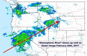
Then the flow of Pacific moisture returned. It was a strong and consistent flow that extended as far into the Pacific Ocean as Hawaii. That flow was rotating off a persistent area of low pressure that continually reformed in the eastern Pacific.
Whenever the moisture connection is continuous and unbroken from near Hawaii to the West Coast of the United States it is referred to as a “Pineapple Express.” In recent years you may have also heard it called an “Atmospheric River.”
The problem with a pineapple connection is the juicy moisture source originates from a region of the Pacific that is more tropical, and it arrives with higher temperatures. That translates to rain at lower elevations. And rain it did in Jackson, turning some streets into “icy-asphalt rivers.”
The long-term average precipitation in Jackson is 1.14 inches in February. The old record February precipitation was 2.83 inches in 1962.
This February was extraordinary for its precipitation, with a total of 5.62 inches as of Feb. 25. I suspect a little more will be added to that number by month’s end.
That now ranks February 2017 as the fourth wettest month in Jackson climate history, bumping October 2016, which saw 5.03 inches of rain, back to fifth place. That means two of Jackson’s wettest months in history happened in the last six months.
We had our all-time wettest month in September 1927, with 6.04 inches of rain. In February of the same year we had a week of weather that was similar to last week, with 2.05 inches of rain falling in just two days and temperatures in the mid-40s. (If you happen to be younger than 90 you wouldn’t remember that event.)
Those precipitation numbers pale in comparison with what California has experienced this past month. There were many places throughout the state that received more than 5 inches of precipitation in a single day.
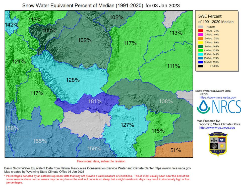
As of last Saturday, Jackson Hole Mountain Resort’s 9,580-foot Rendezvous Bowl had recorded snowfall that tied the February 2014 record snowfall of 134 inches. No doubt more snow has since fallen.
The snowpack has also never been deeper during February in the resort’s 40 years of weather records. The settled snow depth in Rendezvous Bowl topped the 150-inch mark on Feb. 21.
During the biggest winter ever at the resort, 1996-97, snow depths did not reach 150 inches until mid-March. In the higher Sierras snow depths at the end of February were between 200 and 350 inches.
This year I don’t expect all that snow at the higher elevations to melt until late July or early August. Or, perhaps sometime after this next Ice Age is over.
Jim Woodmencey, chief meteorologist at MountainWeather.com, has been forecasting the weather in Jackson Hole and the Teton Mountains for 25 years. Contact him via [email protected]


